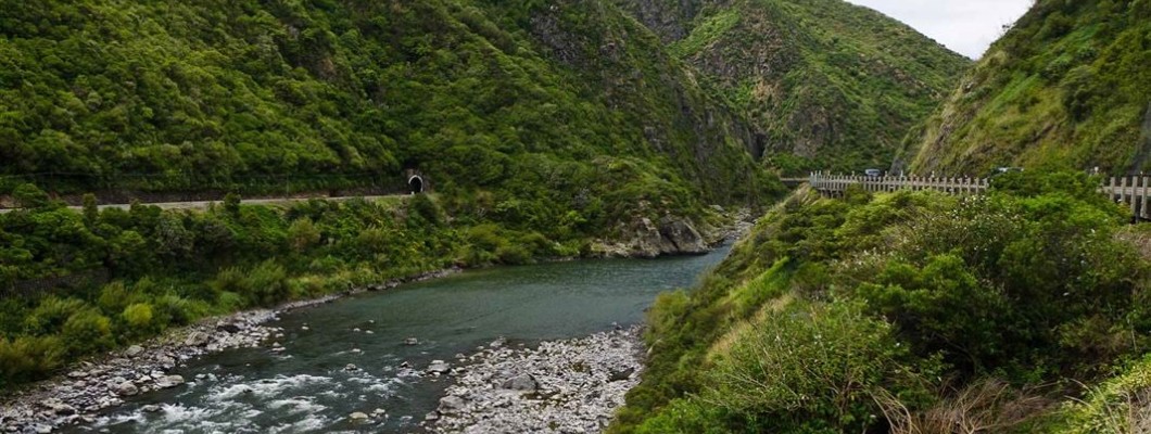
The Manawatū River is a crucial element of New Zealand's North Island, flowing from the Ruahine and Tararua Ranges to the Tasman Sea. Over the years, the river has played a significant role in the area's development, serving as a transportation route for early settlers and providing water for agriculture and industry. Today, it's a cherished natural resource, offering recreational opportunities and sustaining a diverse ecosystem. However, like many rivers worldwide, the Manawatū River faces environmental challenges. In this blog post, we'll delve into the history, geography, wildlife, recreational activities, environmental concerns, and conservation efforts surrounding the Manawatū River. Join us in exploring the rich past and present of this magnificent river and learn how to protect it for future generations.
HISTORY OF THE MANAWATŪ RIVER The Manawatū River boasts a rich history, integral to the region for centuries and deeply significant to Māori communities. The name "Manawatū" originates from the Māori words "manawa" (heart) and "tū" (stand), symbolizing its regional importance.
In the 1800s, the Manawatū River was a primary transportation route for both Māori and European settlers. Riverboats frequently transported goods and people along the waterway. As European settlement grew, the river's role in agriculture expanded, offering irrigation for crops and water sources for livestock.
However, the river has seen considerable changes. In the early 1900s, the Manawatu Gorge railway line's construction and the river's diversion for hydroelectricity generation impacted its flow and ecology. Still, the river remains essential, providing recreational opportunities and bolstering the local economy.
The Manawatū River also holds cultural significance for Māori. Numerous Māori iwi (tribes) have resided in the area for generations, considering the river a part of their rohe (territory). To Māori communities, the river is a treasured taonga with profound cultural and spiritual implications.
GEOGRAPHY OF THE MANAWATŪ RIVER Located on New Zealand's North Island, the Manawatū River flows from the Ruahine Ranges to the Tasman Sea. Spanning approximately 180 kilometers, it ranks as the fourth-longest river on the North Island, with a catchment area of around 2,570 square kilometers. Notably, the river's major tributaries include the Pohangina and Oroua rivers.
The river's geology is particularly striking. Over millions of years, geological processes have shaped its flow, resulting in a unique environment. The upper sections feature steep gorges and valleys, products of extensive erosion, while the lower sections showcase broad channels and vast sand dunes.
WILDLIFE AND ECOLOGY OF THE MANAWATŪ RIVER The Manawatū River is home to a plethora of aquatic life, including species like the longfin eel, brown trout, and koura. The river and its wetlands are vital habitats for native species, with birds such as the pied stilt, New Zealand dabchick, and spotless crake, as well as lizards, frogs, and insects.
RECREATIONAL OPPORTUNITIES ON THE MANAWATŪ RIVER The Manawatū River offers diverse recreational activities. Popular water sports include kayaking, rafting, and swimming. The Palmerston North City Council has enhanced recreational areas along the river, such as the Victoria Esplanade, which boasts playgrounds, gardens, and a miniature train.
ENVIRONMENTAL CONCERNS AND CONSERVATION EFFORTS The river's environment faces challenges, notably pollution from industrial waste and habitat degradation. Both the Horizons Regional Council and the Palmerston North City Council have spearheaded conservation initiatives to safeguard the river's ecosystem. These include refining farming practices, modernizing wastewater treatment, and minimizing harmful chemical usage.
The future of the Manawatū River is promising, but there's more work ahead. By persistently implementing conservation strategies and raising awareness, we can ensure the river remains a cherished natural asset for generations to come.

Leave a Comment